
The idea
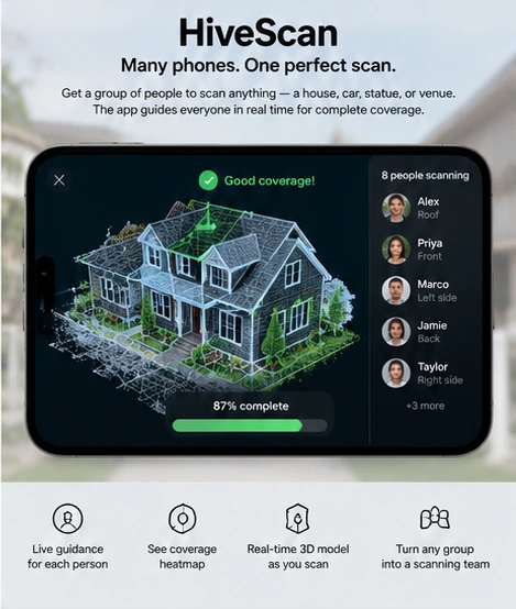
People scan a QR code to join one shared model, see coverage gaps, and receive guidance for views that need another pass.
How it works
- Participants explicitly join with a QR code and contribute views to one scan.
- A coverage map highlights surfaces that still need a useful viewpoint.
- Guidance directs willing participants to a gap, such as a roofline or the far side of a statue.
AI’s role: Turn coverage gaps into useful scanning instructions and coordinate consenting contributors; model merging and surface coverage are computed from sensor data.
First demonstration
Invite a small group to scan a parked car. Show which panels are covered and direct a participant to a missing roof or rear view.
What to solve next
How can coverage guidance adapt to mixed device sensors while making clear what each participant is recording?